120 SHAWMUT RD
Owner Information
LINDEN TREE PARTNERS LLC
65 HOLTON ST
WOBURN, MA 01801


Property Details
120 SHAWMUT RD is classified as a Warehouses for storage of manufactured products (Warehouse).
The primary structure on this property was built in 1974. There are 58,800ft2 of built area within this property. There is 58,800ft2 of residential/living space within this property.
120 SHAWMUT RD is valued at $6,304,900. The land is valued at $2,374,300 and the structures are valued at $3,892,800. There is an additional valuation of $37,800 on this property.
This property is in Zone LI. Confirm with local Zoning Board authorities to ensure there are no overlays or other easements on this property.
The most recent deed for 120 SHAWMUT RD is recorded at the local registrar in Book 29480, Page 205. 120 SHAWMUT RD was last sold on Thursday, December 22, 2011 for $2,650,000.
Assessment data from fiscal year 2022.
Flood Data
According to the FEMA National Flood Hazard Layer, this property does not appear to be in a flood zone. It may also be in an area not yet reviewed. Nonetheless, confirm this information prior to taking any action.
To view the flood hazards around this property, create a FEMA "Firmette" Map of the area around 120 SHAWMUT RD.
Broadband Internet Providers
| Provider | Type | Bandwidth (mbps) | |
|---|---|---|---|
| MCI | Copper Wire | 0 | 0 |
| VSAT Systems, LLC. | Satellite | 2 | 1 |
| HughesNet | Satellite | 25 | 3 |
| GCI Communication Corp. | Satellite | 0 | 0 |
| T-Mobile | Fixed Wireless | 25 | 3 |
| CenturyLink | Copper Wire | 0 | 0 |
| CenturyLink | Fiber | 0 | 0 |
| Broadview Networks Holdings, Inc. | Copper Wire | 0 | 0 |
| PAETEC Communications, Inc | DSL | 0 | 0 |
| CBTS Technology Solutions LLC | Copper Wire | 0 | 0 |
| Comcast | Cable | 1000 | 35 |
| XO Communications | Copper Wire | 0 | 0 |
| TPx Communications | Copper Wire | 0 | 0 |
| Verizon New England Inc. | Fiber | 940 | 880 |
| Verizon New England Inc. | DSL | 7 | 0 |
| Viasat Inc | Satellite | 100 | 3 |
| Crown Castle Fiber | Fiber | 0 | 0 |
Broadband service provider data from December 2020.
Adjacent Properties
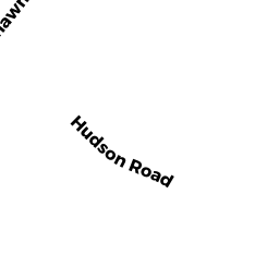
- 40 HUDSON RD
Warehouses for storage of manufactured products owned by PHOENIX ELECTRIC CORP - 40 BEATRICE WAY
Single Family Residential owned by CHELLBERG, VERN T & TRACI D - 90 CEDARCREST RD
Single Family Residential owned by ABEULYAZEED, MICHAEL R & DOSS - 100 CEDARCREST RD
Single Family Residential owned by EGBUTA, CHINYERE C & CHUKU, - 10 BEATRICE WAY
Single Family Residential owned by MORRIS PHILIP I AND COLETTI - 0 CEDARCREST RD
Undevelopable Residential Land owned by VILLAGE AT CEDARCREST HOME - 20 BEATRICE WAY
Single Family Residential owned by ZHANG JING AND GUO JOLIN X - 30 BEATRICE WAY
Single Family Residential owned by BUI, KYLE & NGUYEN, TRIXIE - 125 SHAWMUT RD
Warehouses for storage of manufactured products owned by PPF INDUSTRIAL 125 SHAWMUT LLC - 110 SHAWMUT RD
Warehouses for storage of manufactured products owned by PPF INDUSTRIAL 110 SHAWMUT LLC - 666 SHERMAN ST
Comm. Of Mass. (Other, non-reimbursable) owned by MASS BAY TRANS AUTH